Panoramic map
Combination of orientation and arts and crafts

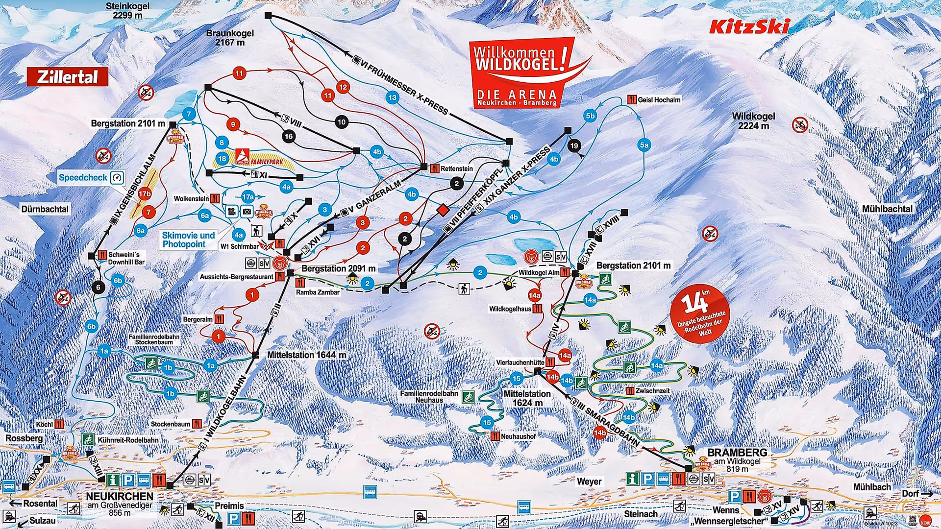
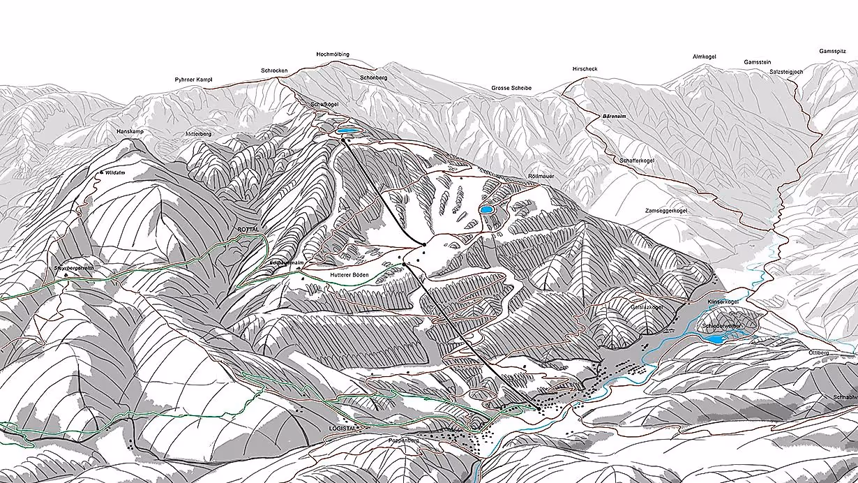
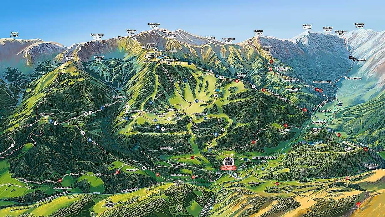
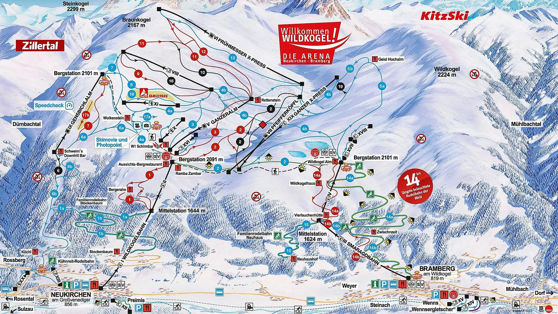
A hand-painted panoramic map from sitour offers a quick, language-independent overview and at the same time all the important detailed information about a ski resort or summer sports region. The detailed depiction of landscapes such as mountains, valleys, forests and tourist infrastructure such as cable cars, pistes, hiking trails, attractions, huts, ... helps guests to find their way around the area easily and safely. Particularly for large regions that encompass several skiing or hiking areas, the panorama map enables individualized illustrations tailored to customer requirements and is therefore the ideal orientation aid - both on site on panorama information systems, piste guidance systems, digital signage systems and also as a print or online piste map or hiking map.
60 years of expertise, experience and attention to detail make sitour's hand-painted panoramas unique. The high-quality winter and summer panorama maps can be produced traditionally on paper or digitally in various graphic styles, depending on the customer's wishes. Hand-painted on paper, acrylic, watercolor, colored pencil or mixed techniques are available. For digitally hand-painted panoramas, the palette ranges from the simpler basic or comic style with a low level of detail to the standard style and the artistic premium style. The latter not only reflects the natural beauty of the landscape with a high level of detail and realistic coloring, but also evokes emotions in the viewer. The style of each panorama is tailored to the needs of the region and the customer, enabling a customized and at the same time artistically valuable presentation of the special features of the landscape and the tourist offer.
The creation of a panoramic map takes place in five steps.
1) The customer's requirements and wishes are recorded in a personal meeting.
2. the area in question is defined using the latest media and technologies (satellite images, aerial photos, terrain photos, etc.) and the optimum viewing angle is determined.
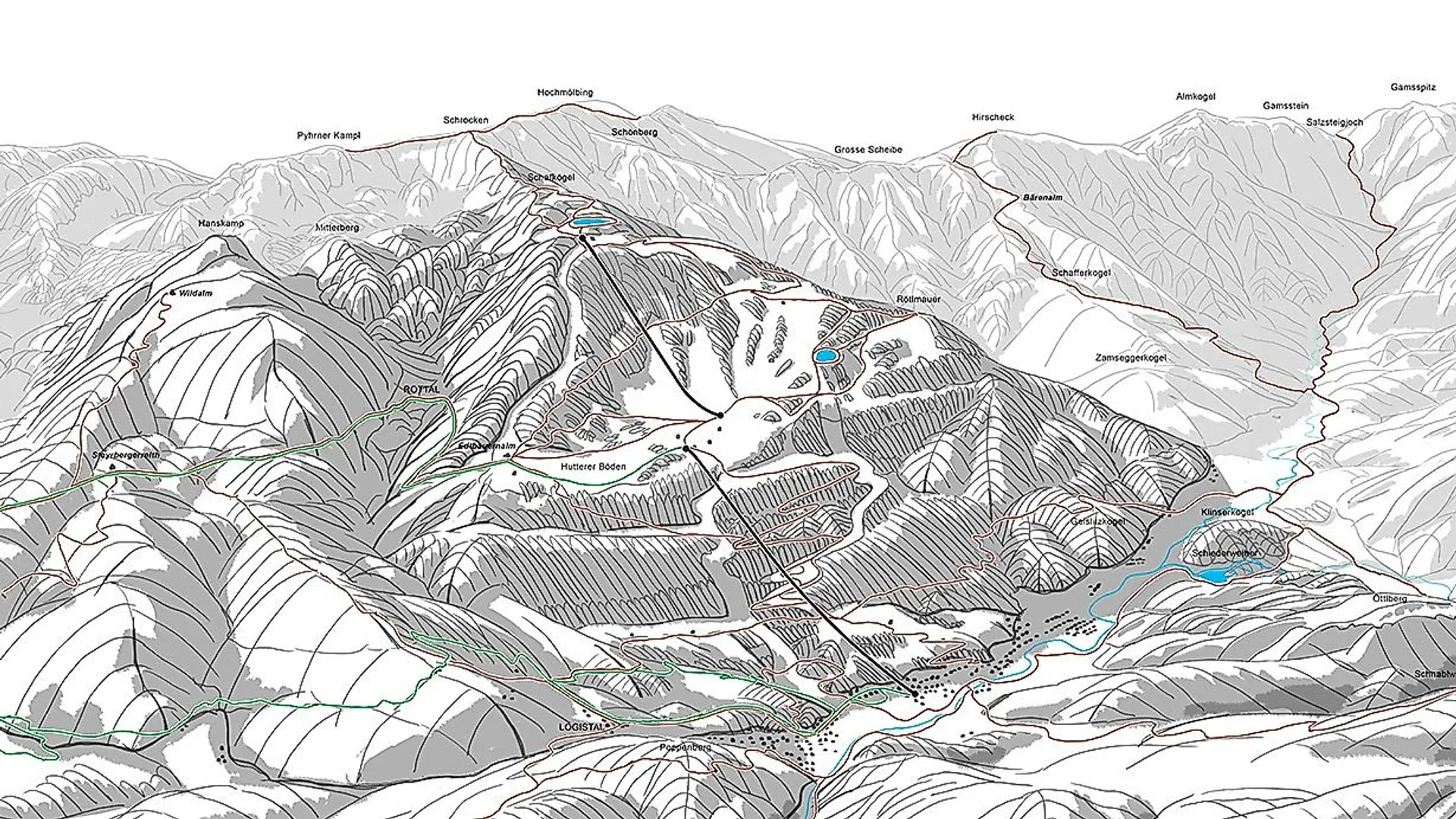
3. an initial sketch is then created, which includes the perspective and geographical details of the area.
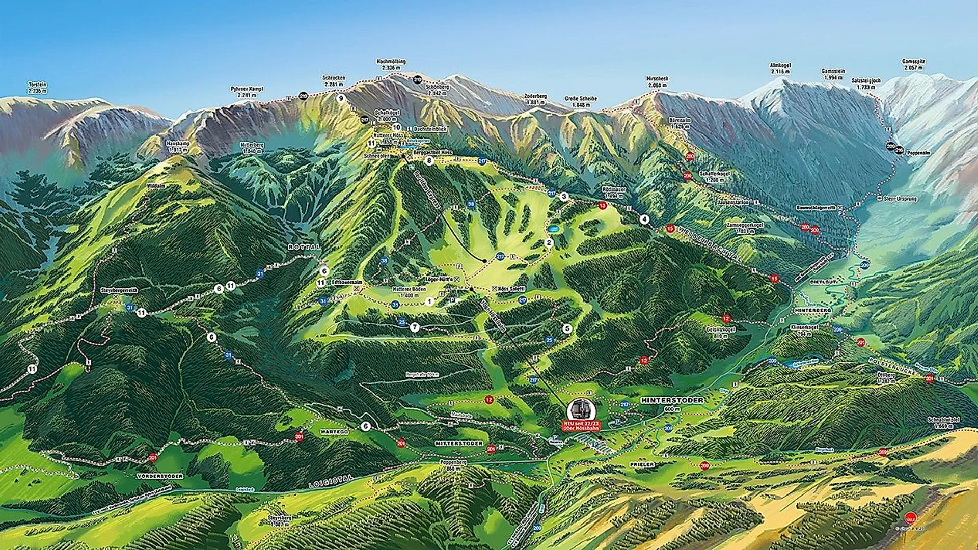
4. after the sketch has been approved by the customer, the final artwork - the actual panorama painting - is created. Whether hand-painted on paper or digitally - mountains and valleys with all their scenic and tourist details are created in meticulous detail using sophisticated techniques. The panorama painters pay great attention to coloring and dimensioning in order to achieve the spatial depth and harmony of the images. The final product is then the finished background of the panoramic map.
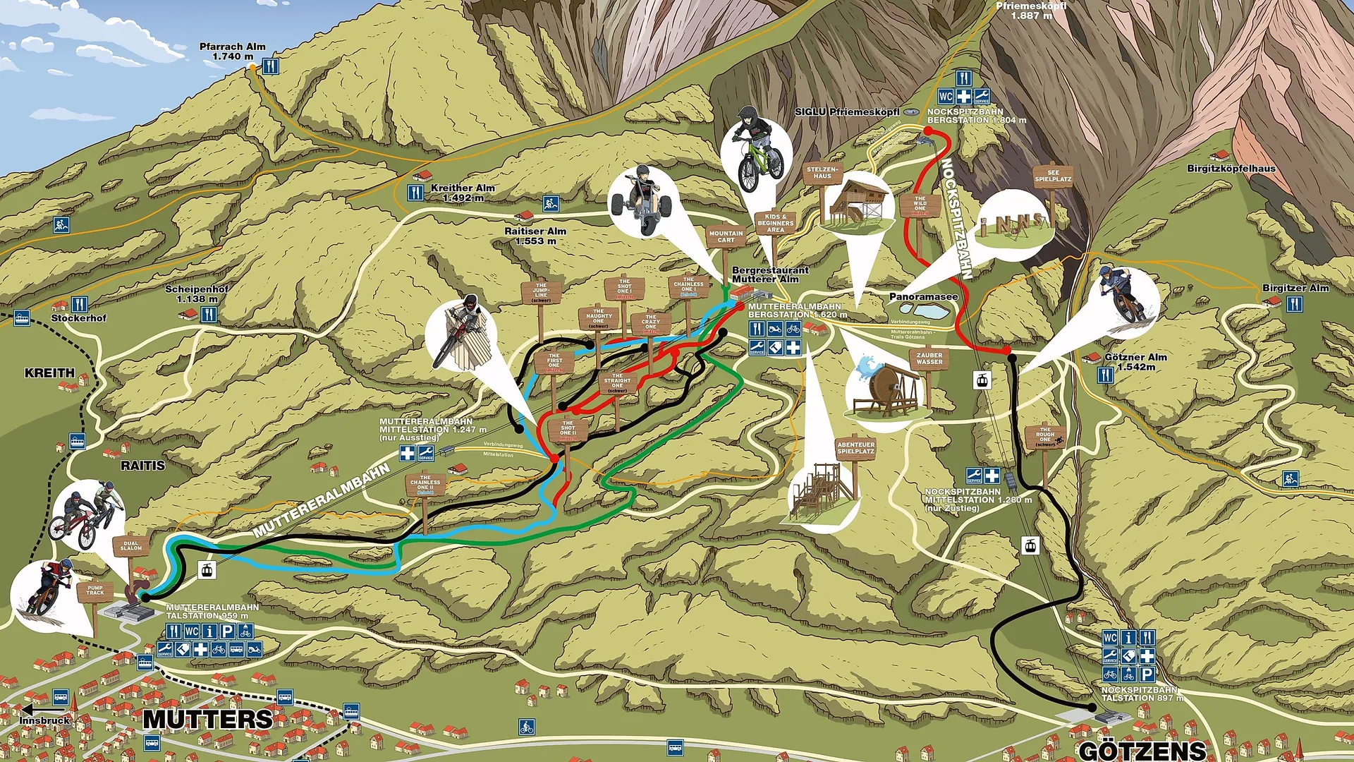
5 The final step is the creation of a digital "overlay", in which additional information such as lifts, slopes, hiking trails, place names, pictograms, legends and much more are digitally drawn in. This is then placed on a separate layer over the hand-painted panoramic background. This means that adjustments to the infrastructure are possible at any time and the panoramic map remains flexible, up-to-date and usable for a long time.
A hand-painted panoramic map thus combines functionality and artistic quality. It is the perfect calling card for the unique landscape and the variety of tourist attractions in an area and creates lasting mountain experiences for guests.
Combination of orientation and arts and crafts
Number of mountain regions with winter and summer panoramic maps
Total number of winter and summer panorama maps
sitour stands for decades of expertise combined with the pursuit of long-term (further) development of market-orientated media and technological innovations for mountain regions.
sitour offers individualised and tailor-made communication concepts for the perfect target group approach in the mountains.
sitour is the largest network of companies specialising in (digital) out-of-home advertising and information technologies in ski resorts and mountain sports regions in the Alps.